Thursday, December 8, 2011

Mid-December Snowstorm "Possibility" Is Becoming A Reality!

A lot of things are pointing to a possible snowstorm in mid-December. First of all if you missed it this is what The Old Farmer's Alamac said. (you can find the 2 month forecast for the Southeast in the link)  http://www.almanac.com/weather/longrange/region/us/4
"Dec 16-20: Rain and snow north, rain south, then sunny, cold"

Second of all, here are hours 216-240 of the GFS showing a pretty good snowstorm next weekend, and pleanty of cold air for it too! (the blue line is the rain/snow line, were temperatures will be at or below freezing)


../GemPakTier/MagGemPakImages/gfs/20111208/18/gfs_wnatl_216_10m_wnd_precip_s.gif
../GemPakTier/MagGemPakImages/gfs/20111208/18/gfs_wnatl_228_10m_wnd_precip_s.gif
../GemPakTier/MagGemPakImages/gfs/20111208/18/gfs_wnatl_240_10m_wnd_precip_s.gif
Third of all, the NAO (North Atlantic Oscillation) for around mid-December looks possibly negative, which usually means a lot of cold air deep south. This is what caused all the cold air and snow last year, even though it was a La Nina year which is usually warm and dry.
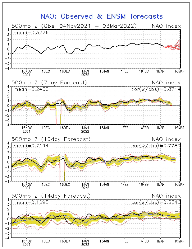
MRF Ensemble North Atlantic Oscillation outlooks


No comments:

Post a Comment