When to Expect Snow
There will be about 3 days of cold weather starting today. Then after that, warmer air will come in. There will be several days of above average temperatures. A lot of areas will see highs in the 60's again. Mid-January that will change. It will be much colder then. It also looks to possibly stormy. Mid-January and early Febuary I think are going to be the best chances for snow. I am now thinking there will be anywhere from 2-5 storms, instead of my earlier prediction that the Southeast gets 2-3 storms. Right now I'm thinking of lot of storms will be in the 1-4 inch range, but I'm not going to take out the chances of there being a storm in the 4-8 inch range, like last year.
What the NAO, AO, and PNA Are Showing
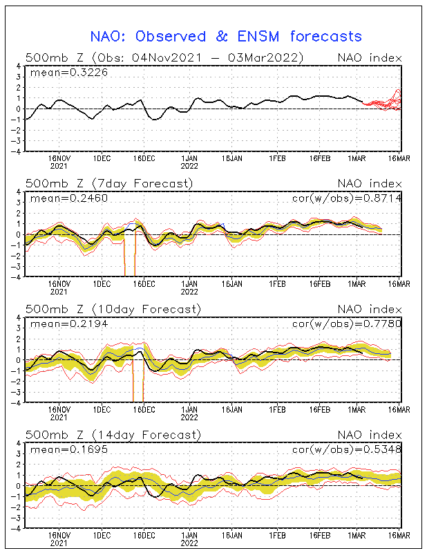
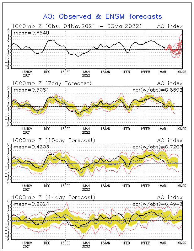
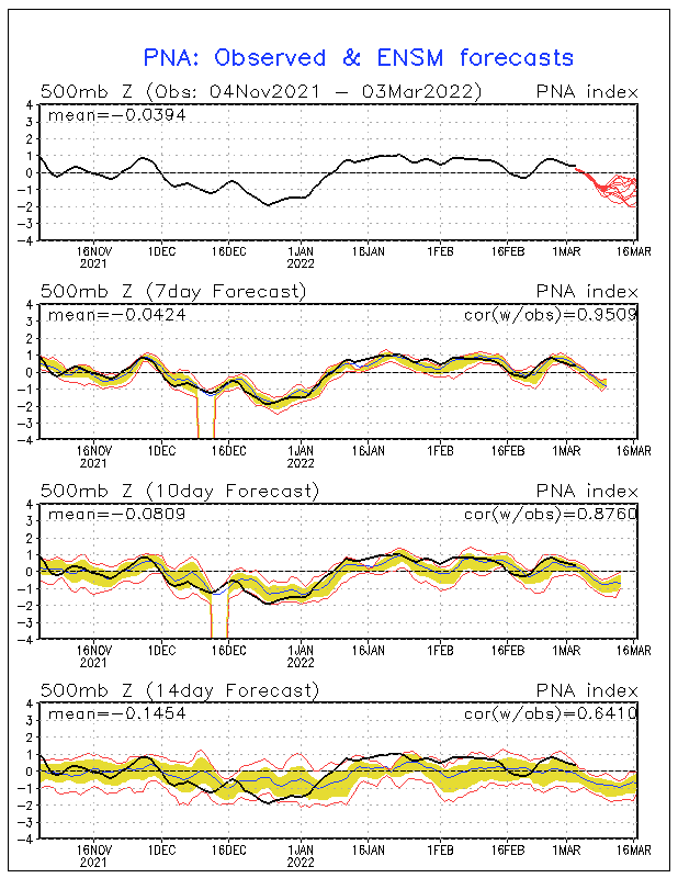
The NAO, AO, and PNA is what I look I look at for cold air. The NAO will likley go negative mid-January. It is too early to tell how long it will stay negative. If it stays negative for a long time, expect much less periods of warth, and much longer periods of cold air. The AO is looking to possibly go negative too. This will enhance the cold air, when both the NAO and AO are negative. The PNA is currently positive, which is also a good thing if you want cold air. The only problem is that it will be negative by mid-January.


Signs Of Snow Already from the GFS
There are already signs that mid-January could be snowy. There is snow showing up from the 13th to 14th for the Southeast, according to the GFS model. I know that the GFS sucks at long-ranged forecasts, but it has shown this storm the past couple of days.
Other Setups
Another setup could be a messy mix of everything including snow, sleet, freezing rain, and rain. Another setup that has a pretty good chance of setting up is a icestorm. This kind of setup wouldn't depend on just the ground temperature, but also in the temperature above the ground. If there is a deep warm layer above the ground, expect freezing rain.
| Setup for Freezing Rain
|


ok so charlotte seeing very little snow this year?
ReplyDeletenc of course
ReplyDeleteNo, looks like some good snow chances next week. Could be a light snow event, or a heavy snow event. Way too early to tell.
ReplyDeletepoop we(charlotte nc)are predicted 9 inches of snow sometime between mid jan. to feb
ReplyDeleteNo, 4-6 inches for the winter.
ReplyDeleteHey we (charlotte nc ) really want snow when will we see it?
ReplyDeleteIt's been a hard winter to forecast. Charlotte,NC hasn't gone 1 year without snow, so I would expect some snow. One good storm could give us average snowfall. I would expect the best chance to be early Febuary, and maybe the last few days of January.
ReplyDelete