Saturday, December 31, 2011
Birds Falling From the Sky Once Again in Beebe, AR
Police in Beebe, AR report that so far, 40-50 birds have falling from the sky there. This happened the same date last year, when thousands of those same type of birds fell from the sky. They think that the cause of the birds falling from the sky are the loud fireworks scaring the birds. You can all see a radar image where there is no precipitation falling, but birds are falling, being picked up by the radar (picture from Brad Panovich).


Friday, December 30, 2011
2012 Atlantic Hurricane Forecast: First Edition
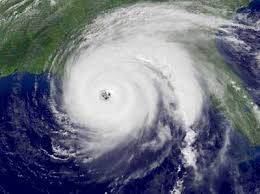
I know it's pretty early to be predicting the hurricane season but here is my prediction. I think this hurricane season will be slightly less active then last year, but still an above average year.
2012 Hurricane Season
Tropical Storms Hurricanes Major Hurricanes
15-18 8-11 3-5
A
V
E
R 11 6 2
A
G
E
2011's Hurricane Season
- Tropical Storms- 19
- Hurricanes- 12
- Major Hurricanes- 5
Thursday, December 29, 2011
NAO Expected to Go Negative Mid January, Also Discussion on Snow
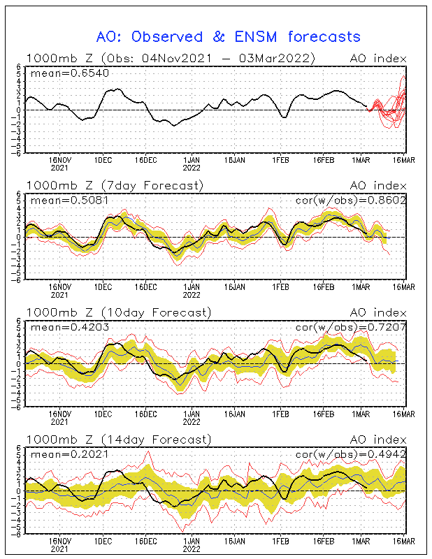
The NAO is expected to go negative around the 11th of January. This might cause a Greenland Block, which would give the East coast more persistent cold air. This is what happened last year, locking the cold air in place. Of course, there is other factors like the AO and PNA tht could also effect the weather pattern. If the AO goes negative while the NAO goes negative, that will also enhance our cold air. We also need the PNA to stay positive, which it will stay through the first part January. It will go negative mid-January. If the Southeast gets snow or not depends on the storm tracks. A storm just off the East coast, a classic Noreaster, would be one of the best chances of snow for the Southeast, especially the Carolinas.

Wednesday, December 28, 2011
Arctic Air Will Arrive Around the 4th of January, GFS Model Looks a Bit Intresting
Artic air will plunge south around the 4th of January. Tuesday, many areas will only make it into the low to mid 40's. The rest of next week, the cold pattern continues. Some time during the week, temperatures might not make it out of the 30's. Lows will be mainly in the lower 20's. There is also a chance that a lot of areas could see there first teens. The place I see with the highest chance of teens for lows, would be the mountains. A quick warm up looks to take place around the 12th to the 13th. This will quickly be replaced by another surge of arctic air. This looks to be what most of January might be like.
There are three slight chances at snow. They are the 5th, the 8th, and the 10th. The 8th looks the most intresting, with a more widspread snow possible. The 5th looks just like a scattered snow snower or snow flurry, which I doubt will happen, and the 10th looks like a tiny bit of snow on the tail end of a storm, which I'm also not buying because it shows this coming all the way down from the main system in the Midwest. I really can't point out any storm tracks anyway, since this is so far out. The GFS will probably be back to showing nothing again tomorrow morning. The GFS is pretty bad at long range forecasting, so don't go crazy over a storm that probably won't exist. The GFS seems to go back and forth on if we will get snow or not. That's why I don't trust it in the long range. We will have to wait several days before knowing more on storms. While it seems to be dry, arctic air, there will eventually be a storm. We already will have our cold air in place, so all we will need is a low. If this happens, which could possibly take place at the end of next week, we could be dealing with a nice snow event. I would also watch closley if the NAO and AO go negative, because that will enhance the chance for a big snowstorm.


There are three slight chances at snow. They are the 5th, the 8th, and the 10th. The 8th looks the most intresting, with a more widspread snow possible. The 5th looks just like a scattered snow snower or snow flurry, which I doubt will happen, and the 10th looks like a tiny bit of snow on the tail end of a storm, which I'm also not buying because it shows this coming all the way down from the main system in the Midwest. I really can't point out any storm tracks anyway, since this is so far out. The GFS will probably be back to showing nothing again tomorrow morning. The GFS is pretty bad at long range forecasting, so don't go crazy over a storm that probably won't exist. The GFS seems to go back and forth on if we will get snow or not. That's why I don't trust it in the long range. We will have to wait several days before knowing more on storms. While it seems to be dry, arctic air, there will eventually be a storm. We already will have our cold air in place, so all we will need is a low. If this happens, which could possibly take place at the end of next week, we could be dealing with a nice snow event. I would also watch closley if the NAO and AO go negative, because that will enhance the chance for a big snowstorm.
Tuesday, December 27, 2011
Chances Are Going Up for Snow Event(s) Next Week for the Southeast
First of all, the GFS is showing a major snowstorm for the Southeast from the 7th to the 9th. This snowstorm will give even Florida a chance for snow, especially Northern Florida. Weirdly enough, the GFS also give south Florida a chance at rare snow. On the 9th of January, the GFS put areas as south as Coral Springs, FL in the chance of snow! Areas like Charlotte,NC (in the lightest shade of blue) is put in the 12-15 inch range for snow (depends on snow to liquid ratio)! Areas just to the north of Charlotte are in the bullseye for the most snow. These areas (shaded in light purple) could get 15-17 inches of snow(depends on snow to liquid ratio)! This is the GFS's best guess to when the arctic air will plunge south.
 |
| GFS Hour 276 |
 |
| GFS Hour 288
The European model shows snow anywhere from January 3rd to the 5th. This shows a pretty similiar setup to what the GFS is thinking. Just like the GFS, this model also brings snow chances to Florida. The rain-snow line are pretty similar, both models putting it over Florida. The European shows much colder temperatures. This model showed the same area getting hit the hardest. It shows Charlotte getting anywhere from 3-5 inches of snow. Just look the GFS model, it shows areas just to the north of Charlotte getting hit the hardest. Areas like Greensboro,NC is in the 5+ inch range.
The forecast could change, so stay tuned. Keep your fingers crossed that is does snow out!
 |
Monday, December 26, 2011
Snow Chances Now for the 4th Through 7th of January

Sunday, December 25, 2011
Cold Air Plunges South Early January, Follows by Possible Snow January 2-3 for the Southeast

Subscribe to:
Posts (Atom)