Showing posts with label 2012. Show all posts

Saturday, October 20, 2012

Hurricane Season So Far VS Prediction

So far there have been 17 tropical storms, 9 hurricanes, and 1 major hurricane. The forecast below was made on December 30, 2011. Everything but the major hurricanes verifies so far, which I forecasted a bit high.                                                  


2012 Atlantic Hurricane Forecast: First Edition

I know it's pretty early to be predicting the hurricane season but here is my prediction. I think this hurricane season will be slightly less active then last year, but still an above average year.
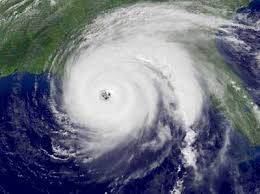
2012 Hurricane Season
  
Tropical Storms               Hurricanes            Major Hurricanes

         15-18                             8-11                             3-5

A
V
E
R             11                                  6                                  2   
A
G
E


2011's Hurricane Season

  • Tropical Storms- 19
  • Hurricanes- 12 
  • Major Hurricanes- 5

Sunday, August 19, 2012

Watching Invest 94L

GFS ensemble members via wunderground.com

Computer models via wunderground.com


Model intensity forecast via wunderground.com


 Click to unzoom
Chance of development via NHC


Saturday, August 18, 2012

What Do We Need for a Perfect Winter?

  • Warm spike from the PDO
  • Weak El Nino
  • Warmest waters off the South American coast
  • +PNA, -NAO, -AO
  • Good storm tracks- storms that rides up the East Coast would be the best case scenario
  • +AMO~ blocking is more likely with a +AMO, rather than a -AMO

August Update: Winter Thoughts

Eastern US
  • Below average temperatures
  • Above average snowfall from the Mid-Atlantic to Southeast
  • Maine will possibly have above average temperatures, because of Greenland Blocking
Midwest US
  • Below average temperatures
  • Big lake-effect snows, because of very warm lakes
Western US
  • Slightly above average temperatures
  • Drier then normal, for some

Friday, July 20, 2012

Look At This Winter- U.S.- JAMSTEC Model

Temperatures: Below normal temperatures for much for United States, besides a small area of slightly above average temperatures from the Great Lakes to the Northwest. As we get closer to the winter, I expect the model to show a larger area of above average temperatures for the West, but I'm sticking with below average temperature for the East Coast, as the factors are hinting on. (El Nino Strength, PDO phase, where the El Nino is centered)

Precipitation: Above average precipitation for much of the East Coast, especially the Southeast. The combination of below average temperatures and above average precipitation in this area could mean it could be a pretty snowy winter ahead. One analogue year I am using is 09-10. I'm not saying yet that it will be quite as cold and snowy, but this winter could be similar. One thing I can say for sure: get your shovels ready if you live in the Northeast and Southeast, because this definitely not a repeat of last year. Above average precipitation would also help out drought in this area. Slightly below average precipitation for much of the West, Midwest, and even portions of the Northeast.